As I think back on this experience, I think of how fun it was and what a good experience it was.
But I'm not sure why I think that, because I don't think I was thinking that while I was actually there. While I was there, I was thinking more along the lines of:
This crammed tent is sure uncomfortable. That outhouse smells terrible. When is it going to stop raining? My back is so sweaty. Where is that blasted contact between the Mississippian limestone and the Cambrian limestone? This mountain is hard to get up. This mountain is even harder to get down. Why does that pesky limestone look and act like quartzite? I just want to take a shower.
But it was a fantastic experience, and I'm glad I did it.
(I'm including pictures, but I have to make some disclaimers. First, I never claimed to be a photographer; these are meant to be informative more than they are meant to be beautiful. Most of them are quite awful. I just use a little point-and-shoot camera. This is a new camera, since my last one was six years old. I tried to take these pictures quickly, so I didn't mess with settings. Most of them have too much light.)
(Also, I was going to go into more detail about the geology, but I would have to look a lot of things up, and it would take too long.)
On Monday morning, we met up by the Eyring Science Center to load up into the geology vans to head to Little Cottonwood Canyon. I rode with a TA named Rachel, who was in my geomorphology class last year.
We stopped at a hill looking up into the canyon. Our professor, Dr. Ron Harris, instructed us. There we learned a little about the 10,000-year-old glacial moraine of the canyon and learned about earthquakes. The Wasatch Fault has an earthquake on average of every 1,250 years. It has been 1,350 years since the last one. If the "big one" hit Utah tomorrow, according to Dr. Harris, no geologist in the state would be surprised. Others might be, but not geologists.
Next we stopped at a place called Lisa Falls.

Next we stopped at Snowbird to look at the mountains. There are some interesting features here.


After we saw this, we headed to our campgrounds. Apparently this was the biggest Geology 210 group ever, so we split up into different camps. I had signed up to be in someone's tent, so I had to go where he chose. He chose to go to Albion Basin, which is about 10,000 feet in elevation, in the midst of a glacial cirque. This campground is more primitive, meaning it just had vault toilets, which aren't great, but I grew up with them. It was quite rainy, so we didn't do much the rest of that evening. Some of the time we sat in the vans to wait for the rain to stop. I was listening to my little MP3 player, and by chance both versions I have of Vince Guaraldi's "Rain, Rain, Go Away" came on.
In a lot of my classes at BYU, there has been one person who is really annoying in classes. This person often sits at the front of the room and always has something to say. Sometimes the comments are dumb. Sometimes the comments are obviously intended to show how much the person knows. And it is always a guy. When I took Geology 112 last winter, this annoying guy was incarnated as a middle-age man who seemed to think he knew more than he did. (For example, he once was talking about "Milo Farnsworth," when he meant Philo, and once he said that dimetrodon was his favorite dinosaur--and the professor had to tell him that it wasn't a dinosaur.) Well, this Mr. Know It All was in my camp, and he also signed up for the same tent I did. But he didn't tell the owner of the tent that he had brought a cot. Not a pad or a tiny air mattress, but a full cot. If you're going to bring a cot, you should either have your own tent, or at least inform the person whose tent you're in that you're going to have a cot. This guy continued to be a Mr. Know It All in this class, but fortunately I didn't spend too much time around him.
The next morning (Tuesday) we went out to an outcrop of the Ophir shale. Although it is called the Ophir shale, it is really slate, which is metamorphosed shale. We saw some trilobite tracks in the shale. Here we learned how to take the strike and dip with our compasses. The dip is how much a bedding plane is tilted. You put the strike and dip on a map.
Then we got our maps. They gave us maps that had some landmarks and topographic lines. Our assignment for the next few days was to go out and color in the rock types and other features on our map. We got mapping partners, and then we set out to work. Even though we had partners, we ended up staying with a whole group most of the time. My partner's name was Scott; the others in the group were named Rob, Corbin, Hannah, and Shani. Rachel the TA was with us and helped us most of the time.
Our first outcrop was the Alta stock, another granite inclusion. It had a slightly different composition than the Little Cottonwood stock. Then we found the Tintic Quartzite. The Tintic Quartzite formed in the Cambrian period, after the supercontinent Rodinia broke up. Utah at that time was on the coast, so it was a sandy beach. It is those sands that formed the Tintic quartzite.
Cut through the quartzite--and lots of other rocks--were dikes, which are igneous intrusions that go straight up. The dikes were more mafic than the granite, which means they had more iron and were darker. Then we found the Ophir shale. The Ophir shale is also Cambrian in age; it formed when the sea got deeper and the water transgressed further onto the continent.This particular outcrop of shale was more metamorphosed than the one we had seen earlier in the day because it was right next to the granite intrusion. The heat from the magma body metamorphosed it more at that location.
My partner and I climbed up the mountain to an outcrop of Cambrian limestone. Limestone forms from calcite deposits from organisms in deep marine environments. We knew it was limestone because, for one thing, it fizzed when we put hydrochloric acid on it. This is our view from that outcrop:


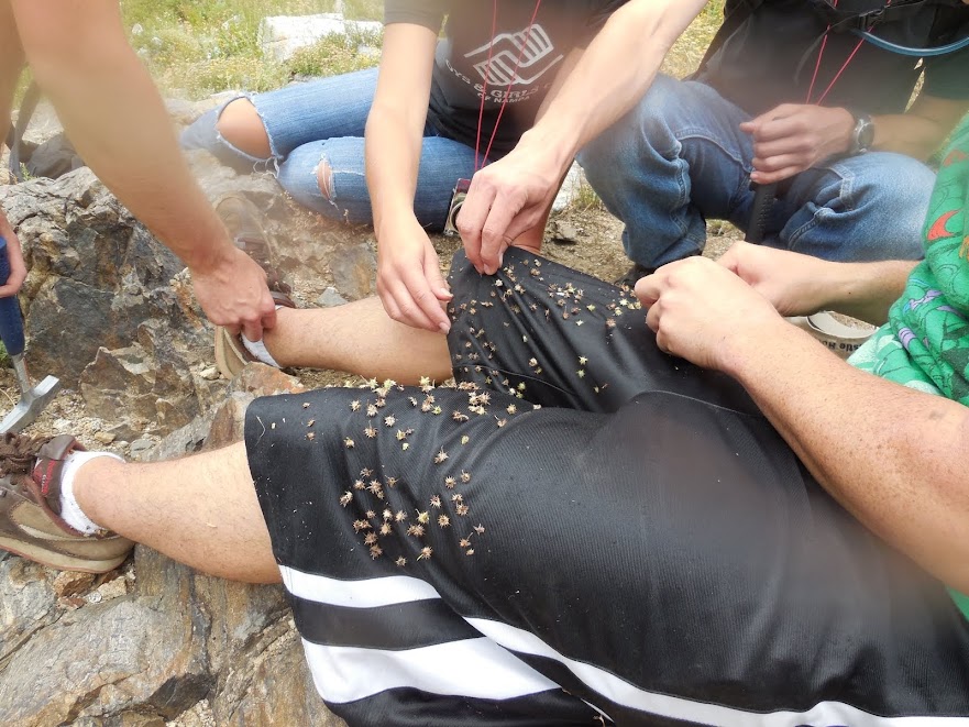
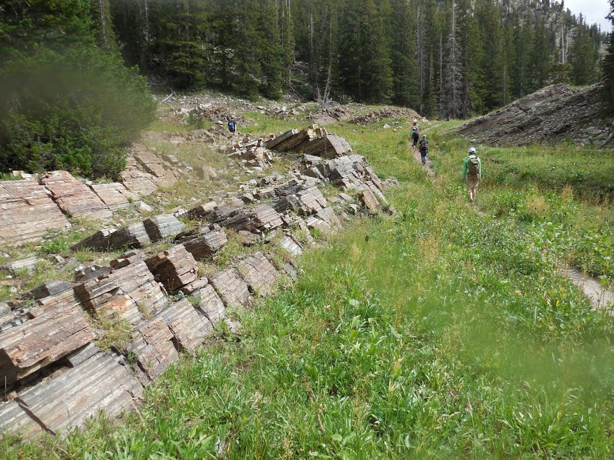
On Wednesday morning, we headed out to the other side of the area we needed to map. The weather wasn't as great on this day. There were some patchy clouds, but overall it was sunny. We saw lots and lots of Tintic quartzite on the path up to Cecret Lake. I think they spell it "Cecret" because it's not much of a secret. There were lots of people on that trail, and we heard some kids talking about a quartzite outcrop: "This isn't clay. This is rock!" "Yeah, stone!" We could have told them exactly what it was, but we didn't. We found some more dikes in the quartzite. Then we made it up to Cecret Lake.


On Thursday, we climbed to where we left off the day before. It was a long, steep trail, and it was muggy, so we got pretty sweaty. I couldn't go as fast as the rest of my group, but there was one girl who was really slow, so I wasn't the last one. When we got to the top, it was cold and windy and made our sweat really cold.
The limestone in that location really was Cambrian limestone (thrust on top of Mississippian from a fault). It was white marble. In the midst of one outcrop, I found the world's tiniest Christmas tree:


We went to a restaurant/lodge at Alta. It was just a little place run by a BYU alum. We looked at the menus and kind of panicked. There wasn't much on the menu (our host told us that their one chef was a gourmet Boston chef), and what was there was really expensive. The salads ranged from $8 to $11. Most of the meals were more than $20. The waiter told us that the meals were pretty big; when he described the steak, he said it was huge. The TA and the five other people of my group ordered regular meals but split them, while Dr. Harris and I just ordered salads. When we got our food, we wondered why they said the portions were big, because they weren't. Few of us were actually full afterwards (we wanted to go someplace else afterwards, but it was too late). The salad was small, definitely not big enough for a meal, and most definitely overpriced. The steaks were not as big as the waiter said. They might have been a sufficient meal for one person, but not for two people, and poor college students are not going to fork over $25 for one meal.
Notwithstanding small portions and ridiculous prices, we had a good visit with Dr. Harris. He asked everyone why they got into geology, and Rachel said, "Excluding you two," pointing to Rob and me, since we weren't geology majors. Rob was a physical science education major, and this class is required for that. Dr. Harris asked if I was also that major. I said, "No. English linguistics." There was a little bit of laughter, and Dr. Harris said (not in a mean way), "You're the kind of person I try to get out of my class," since sometimes there's not room for everyone in geology. (But I do think there were still some open spots in the class, and I did get permission from Dr. Morris, who will be teaching the class this coming week.) He did say he had no problem with linguistics, and Rachel assured him that I was a geology minor. He told us the story of how he met with the First Presidency and got them to tear down Deseret Towers at BYU, since they weren't earthquake-safe. I asked him about the crystal I had found; he found out it was garnet by scratching it into a dinner knife. (I guess that was our way of sticking it to the man--if you're going to charge so much for a meal, you should let us scratch your silverware!) We left and went back to camp, sad that it was too late to go get more food.
The last day, Friday, Dr. Harris showed us lots of things that we had missed. For example, he showed us this fault. Quartzite is on the left and shale (or slate) is on the right. The shale should be on top of the quartzite.


It was cold and rainy--more like November than August--so we left. We went to a posh resort to finish working on our maps. And we were so excited to come back to Provo and take showers.
I came home with a bunch of rock samples. It seemed like a good idea at the time, but now I think, "What am I going to do with all these rocks?" Except for the garnet. The garnet's pretty cool.
I did take a razor with me, but I didn't shave. I don't think the geology department cares whether I shave, so I'm growing my beard out until school really starts. I've never done so before. This is my beard as of Friday night (it's darker than it looks in this picture):

Then on Saturday we had to go to class to refinish our maps based on feedback the TAs got us. I got Bs on most of my stuff, so in this class I probably won't get the kinds of grades I'm used to, but oh well.
This class did make me a little sad. I'm getting close to the end of my geological career, and this class made me realize I'm not cut out to be a geologist. I just didn't see the same things everyone else saw. Also, geologists are better hikers than I am. I was slower than most of my teammates, and Dr. Harris walked really fast. I suppose that's why I'm going to be an editor instead of a geologist.
And no, I didn't lick any rocks on this trip.
No comments:
Post a Comment